Publications
"What we observe is not nature itself, but nature exposed to our method of questioning"
- Werner Heisenberg
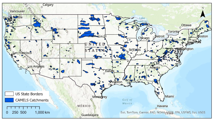
Deep Learning Approaches for Streamflow Flash Drought Prediction Across the Contiguous United States
Journal of Hydrology
This study evaluates whether deep learning models can improve the prediction of streamflow flash droughts. Three models were compared using data from 671 catchments across the United States. The Transformer-based model consistently achieved the highest prediction accuracy and flash drought detection, demonstrating its potential for drought early warning and water resources management.
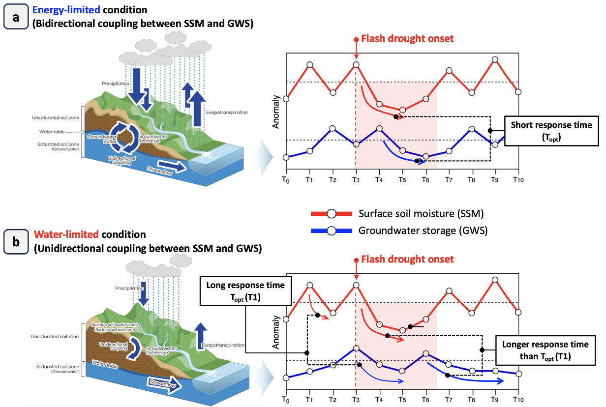
Dynamics of groundwater-land surface response times as a dryland flash drought diagnosis
Communications Earth & Environment (Nature Portfolio)
How fast does a drought sink into the ground?
Flash droughts can dry out a green landscape in weeks, and catching them early is hard. Our new study examines an overlooked underground clue: how quickly moisture anomalies at the surface travel down to groundwater, a measure we call the groundwater-land surface response time. Mapping it globally with a dynamic exponential filter, we found that in drylands this response time is long and flash droughts are frequent, because a combined evapotranspiration and runoff deficit stretches the response out and weakens its link to drought behavior. But in wetter seasons the response time reacts quickly and in both directions with flash drought onset and timing, making it a promising early warning signal precisely when early action matters most.
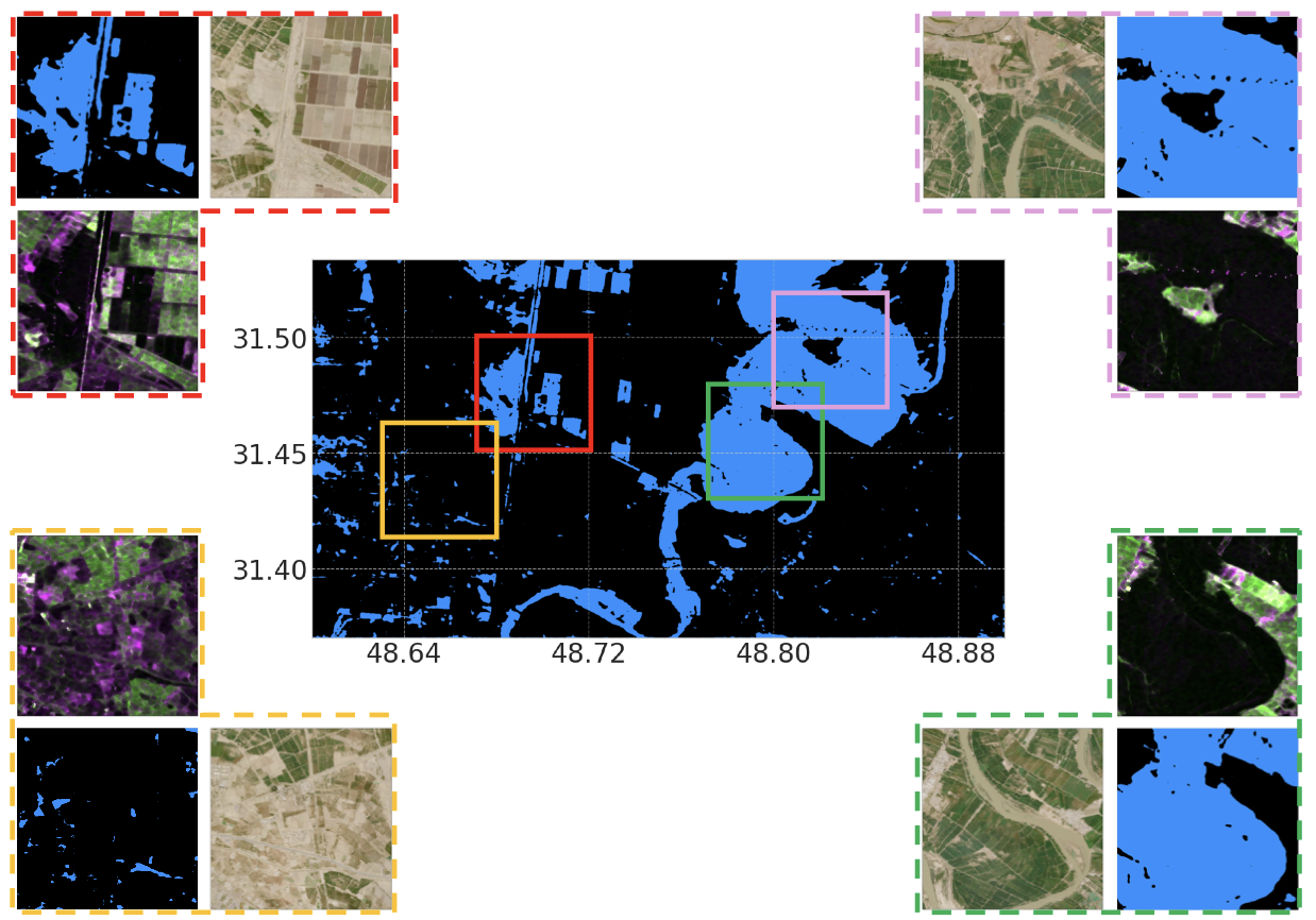
Enhancing Detection of Inundated Areas using Novel Hybrid PolSAR-Metaheuristic-Deep Learning Models
IEEE Journal of Selected Topics in Applied Earth Observations and Remote Sensing
To address the limitations of cloud cover and misclassification in traditional flood mapping, this study introduces a novel hybrid framework that combines metaheuristic optimization algorithms with deep learning semantic segmentation models. By applying this methodology to Sentinel-1 SAR imagery of the 2019 Iran flood, the integration of a Swarm-based Simulated Annealing feature selection technique with a CPNet architecture achieved highly precise, high-resolution flood extent mapping.
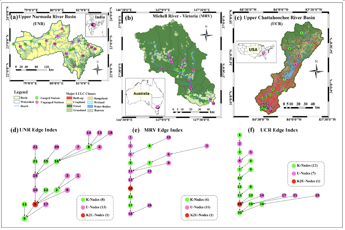
Process Guided Graph-based Transformer Learning for Streamflow Predictions in Data-Sparse River Basins
Journal of Hydrology
This study introduces a novel Process-Guided Graph Transformer framework that combines hydrological modeling with Graph Neural Networks and Transformers to improve streamflow prediction in ungauged and data-sparse river basins.
The proposed framework demonstrated improved prediction accuracy, extreme-event detection, and computational efficiency across river basins in India, Australia, and the United States.
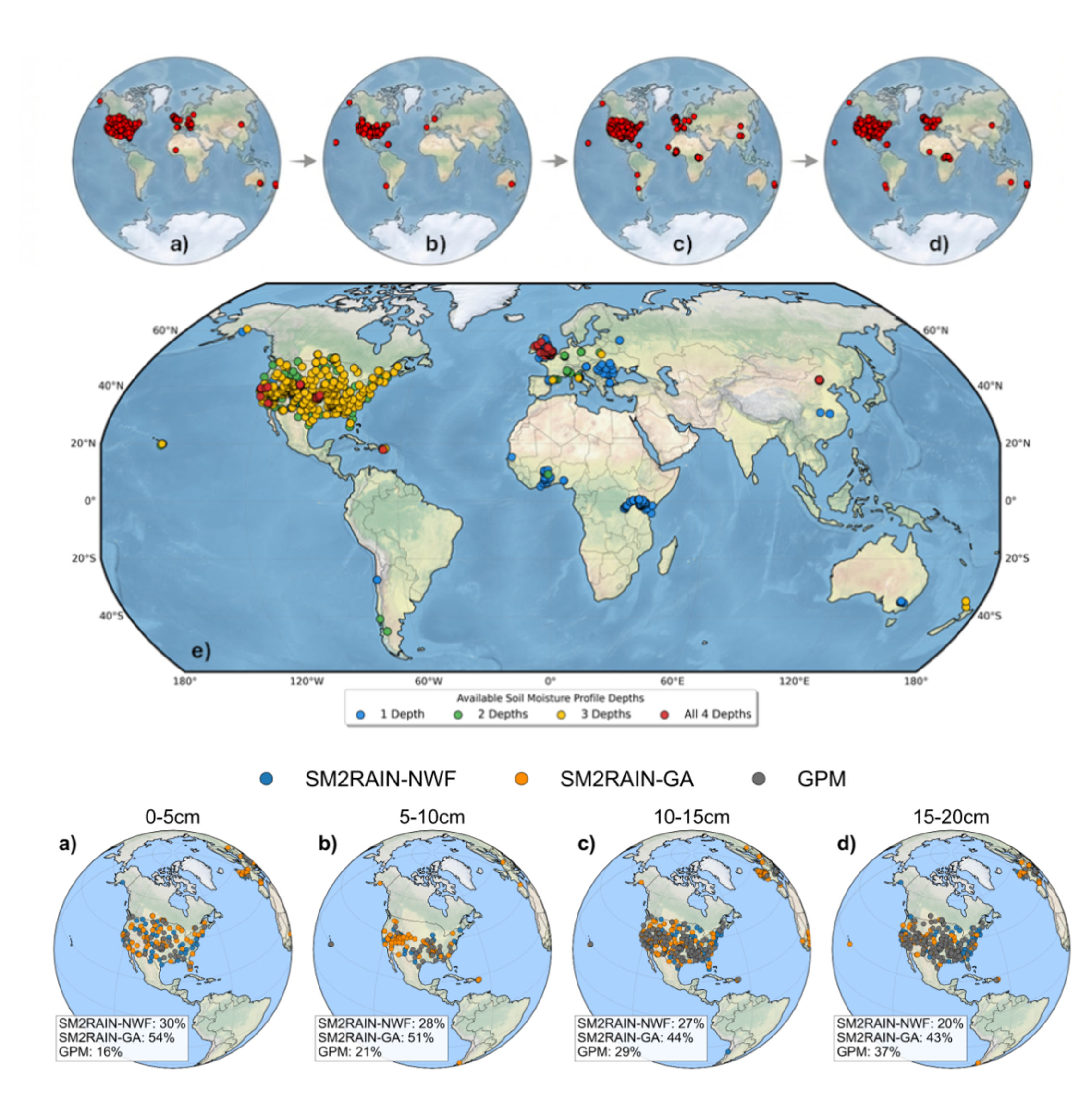
Beyond satellite-based precipitation data: A novel soil moisture physics framework with Green–Ampt and Bayesian optimization for rainfall estimation
npj Climate and Atmospheric Science (Nature Portfolio)
SM2RAIN rainfall estimation is limited by infiltration physics and soil moisture depth. This study introduces a Green-Ampt based approach and optimizes parameters using Bayesian methods, improving rainfall retrieval accuracy, though performance decreases with depth. Results highlight land cover dependent behavior and provide more reliable rainfall estimates with quantified uncertainty.
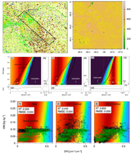
Simultaneous Estimation of Soil Moisture and Soil Organic Matter from Dielectric Measurements - Part 1: Optimal Estimation Strategy
Agricultural and Forest Meteorology
This study presents a refined optimal estimation approach to simultaneously retrieve soil moisture and soil organic matter from microwave dielectric measurements. Unlike conventional models that focus only on soil moisture, the proposed method explicitly incorporates organic matter into a continuous dielectric mixing framework, reducing ambiguity in dual-parameter estimation. Validation using SMAPVEX12 field data demonstrates strong agreement for both soil moisture and organic matter estimates. The approach improves retrieval accuracy and enables the use of microwave sensors for assessing soil carbon content, with direct applications in irrigation management, soil health monitoring, and carbon accounting.
