Significance of Water Body Detection Using Satellite Remote Sensing
With climate change intensifying rainfall extremes, droughts, and seasonal water variability, the timely detection of surface water bodies has become increasingly important. Flooded areas expand and contract rapidly, while many data denied regions lack ground monitoring networks. Reliable information on when and where water is present is essential for flood early warning, agricultural water management, disaster response, and environmental protection.
Conventional methods rely on in situ observations or manual interpretation of optical imagery, which are often limited by cloud cover, sensor availability, and measurement costs. These limitations are exactly where AI can add value, by automatically identifying water features and learning spatiotemporal patterns from diverse satellite sensors without relying entirely on manual thresholds or human-driven interpretation. This helps fill critical blind spots, especially during extreme events when real time decision making is needed most.
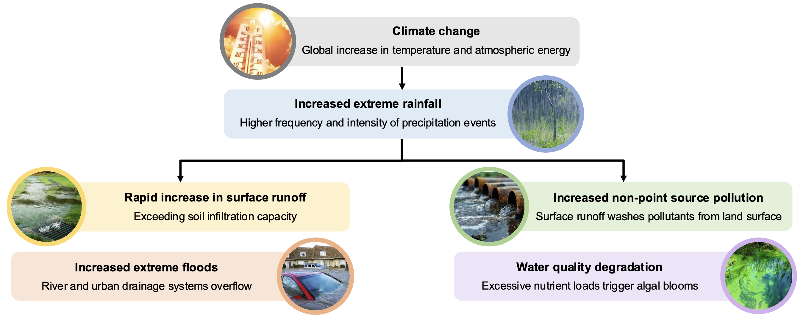
Conventional methods rely on in situ observations or manual interpretation of optical imagery, which are often limited by cloud cover, sensor availability, and measurement costs. This creates critical blind spots, especially during extreme events when real time decision making is needed most.
Our Goal
We aim to develop a robust and scalable water body detection framework using satellite based observations from CYGNSS and Sentinel combined with AI based classification. By integrating active reflected GNSS signals with high resolution optical observations, and by applying AI models such as convolutional networks and temporal feature learning methods, our research seeks to map inundated areas with improved spatial coverage, higher revisit frequency, and stronger performance in data limited regions.
Our goal is to detect permanent and temporary surface water with high reliability, particularly in areas with limited ground measurements and frequent cloud contamination.
Our Approach
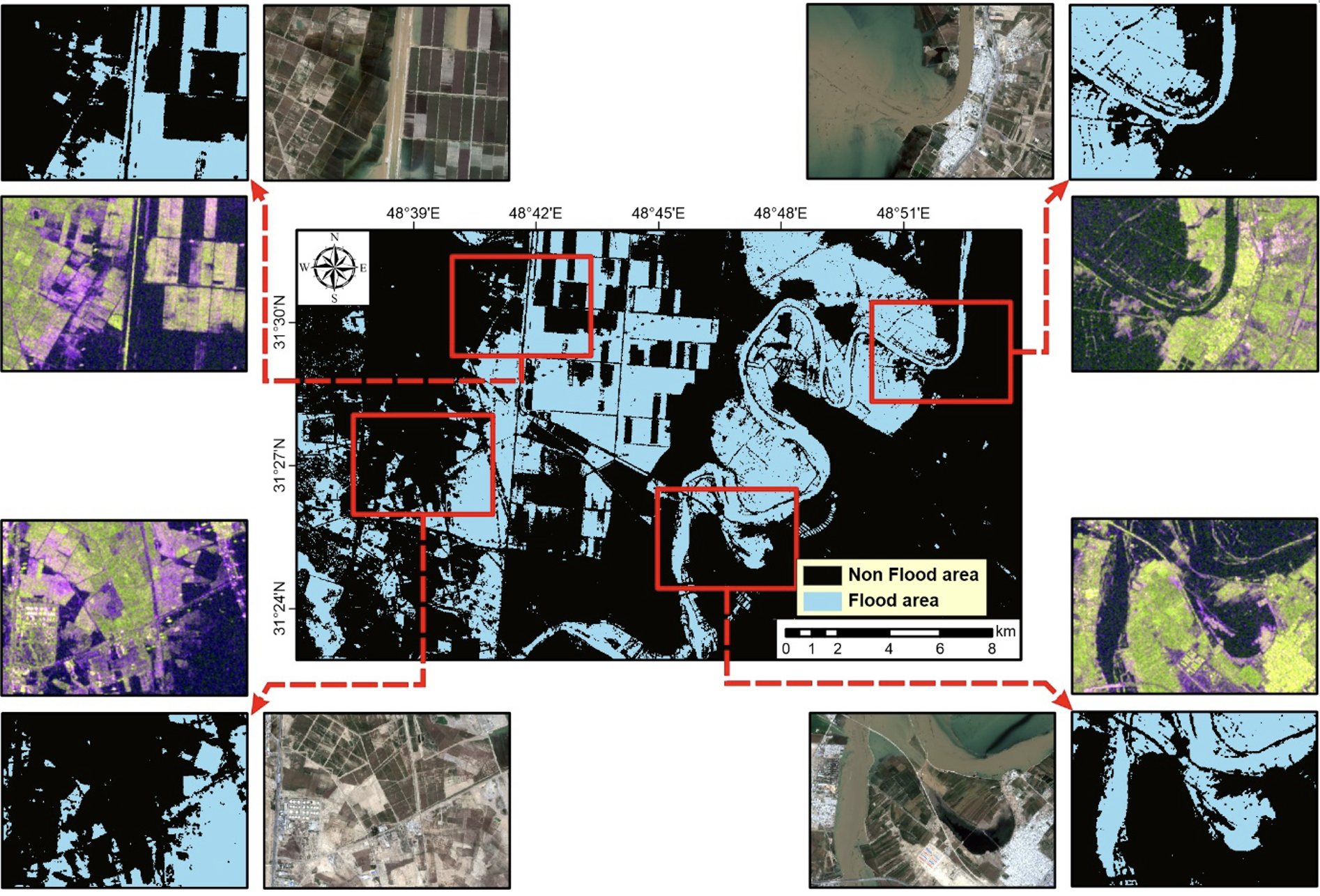
Our approach integrates CYGNSS Delay Doppler Map based reflectivity with Sentinel based spectral information, and applies AI driven classification to detect water presence and characterize wet surface conditions. CYGNSS provides frequent observations even under clouds and vegetation canopies, while Sentinel offers fine spatial detail for classification and boundary delineation. AI plays a central role in fusing these complementary datasets, learning discriminative features, and generalizing across land cover types and climate regimes.
By combining these strengths, our framework captures both dynamic water expansion during flood events and stable water surfaces in lakes, rivers, and wetlands.
Future directions include incorporating multi temporal analysis, vegetation attenuation correction, and deep learning based fusion for improved performance across seasons and land cover types. We also plan to extend our approach to monitor drought induced water shrinkage and rapid flood events using AI based temporal sequence modeling.
Tools and Expertise
Our research builds on advanced remote sensing and data science capabilities:
Programming: Python and deep learning libraries for processing and modeling
Satellite Analysis: CYGNSS reflectivity, Sentinel spectral indices, and geospatial fusion
Spatial Analysis: GIS techniques for mapping, masking, and change detection
Computing: GPU accelerated workflows for large scale satellite datasets
Domain Knowledge: Expertise in hydrology, flood processes, and remote sensing retrievals
Key Areas of Research Interest
In addition to water body detection, our project explores the following topics:
(1) Assessing the value of CYGNSS for flood monitoring in cloudy and densely vegetated regions
(2) Detecting temporary inundation during storm events and monsoon seasons
(3) Developing AI based fusion methods for CYGNSS and optical sensors
(4) Evaluating data scarcity issues in countries with limited ground observations
(5) Quantifying uncertainty associated with sensor noise and vegetation effects
(6) Extending the approach to drought monitoring and seasonal water storage change
By advancing these methods, our research aims to strengthen water related disaster management, enhance environmental monitoring, and provide a scalable solution for regions where real time surface water information is urgently needed.